Northern AZ U Tackles Accessibility Mapping Project
- By Dian Schaffhauser
- 10/21/20
Northern Arizona University is working with Quantum Spatial, a geospatial data company, to develop an accessibility map to help people with mobility issues more easily navigate the hilly campus.
Currently, three units on campus — the Department of Geography, Planning and Recreation; Astronomy and Planetary Science and the Commission on Disability Access and Design —are working with Quantum Spatial to run a LiDAR survey across the Flagstaff campus. Light Detection and Ranging (LIDaR) uses remote sensing to examine the surface of an area.
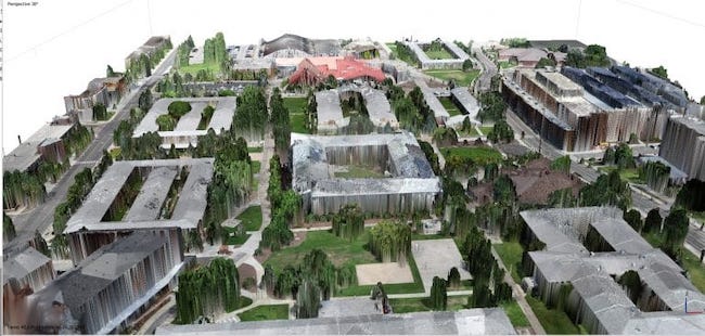
With the use of drones and a terrestrial laser scanner, the team will develop a high-resolution map. The resulting map will help the university provide accurate information about slope and other path-of-travel features to determine the best routes for those who use wheelchairs or want to avoid stairs. Once this first stage is complete, NAU will enhance the map to work with assistive technology, such as screen readers for users with vision impairments.
"NAU is committed to campus accessibility that goes beyond the Americans with Disabilities Act. As part of this, we had the idea to develop an innovative tool that not only provides a fully accessible map of the campus, but also makes an inherently visual solution available to those with visual impairments," said Lauren Copeland-Glenn, program manager with the university's Equity and Access Office, in a statement.
"The Quantum Spatial team thrives when given the opportunity to discover new and interesting ways to apply the geospatial information we collect, which is why the NAU project is so compelling," added Scott Nowicki, lead R&D scientist at the company. "This project developing a uniquely-detailed high-resolution model of the exterior campus environment will provide all students, staff and visitors with a valuable resource to help them easily navigate the sprawling campus."
About the Author
Dian Schaffhauser is a former senior contributing editor for 1105 Media's education publications THE Journal, Campus Technology and Spaces4Learning.